This is Ergani.
This is Ergani.
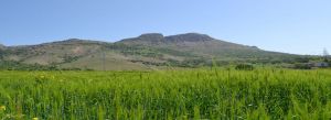
At a distance of 10 km from the right bank of the Dicle and among the people, Zülküf Mountain, Zülküf (Zülkifl) Prophet Mountain, named as Makam Mountain, is established on the southern slope of the 1526 meter high Zülküf Mountain and is one of the important districts of Diyarbakır. Ergani is the largest district of Diyarbakir province. There are 86 villages attached to the district headquarters.
At a distance of 10 km from the right bank of the Dicle and among the people, Zülküf Mountain, Zülküf (Zülkifl) Prophet Mountain, named as Makam Mountain, is established on the southern slope of the 1526 meter high Zülküf Mountain and is one of the important districts of Diyarbakır. Ergani is the largest district of Diyarbakir province. There are 86 villages attached to the district headquarters.
Ergani is one of the numbered settlement units of Upper Mesopotamia, and is mentioned by the names of Akranya, Erkenin, Erkanikana, Yanari, Zülkarneyn, Arsania, Urhana, Ashtat.
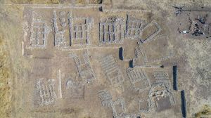
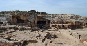
It's seven kilometers from the county. Excavations at Çayönü in the village of Sesverenpınar (Hilar) in the southwest indicate that the settlement in the area dates back to BC. It showed that it started between 7250-6750 AD.
The 19th. Towards the end of the century, a new settlement was formed on the site of today's city under the name of Osmaniye and the old Ergani faded. However, the name Osmaniye given here was confused with Osmaniye in Adana and after the proclamation of the Republic it was given the name Ergani again.


