The route of Konya Meram

Its altitude is 1016 m. It has an area of 1949 square kilometers. Meram district is located in the south and southwest of Konya. It is at the crossroads of five important roads: Ankara-Konya, Isparta-Konya, Antalya-Konya, Mersin-Konya and Adana-Konya. It is bordered to the north by Selçuklu, to the ...

The route of Konya Meram

Its altitude is 1016 m. It has an area of 1949 square kilometers. Meram district is located in the south and southwest of Konya. It is at the crossroads of five important roads: Ankara-Konya, Isparta-Konya, Antalya-Konya, Mersin-Konya and Adana-Konya. It is bordered to the north by Selçuklu, to the south by Çumra, Akören and Bozkır, to the west by Beyşehir and Seydişehir, and to the east by Karatay.

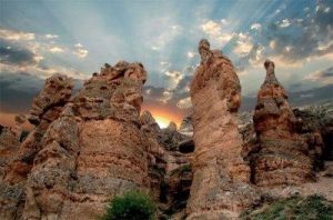
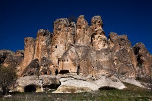
The Rock of Girls
The Rock of Girls

The Rock of Girls is actually a landform that resembles peribacas, formed by wind and water erosion at a location ...

devamını oku
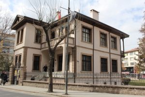
Atatürk House Museum Konya

The Ataturk House Museum is a monument to the life and leadership of Mustafa Kemal Ataturk, journeying deep into history. ...

devamını oku
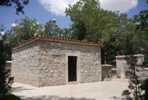
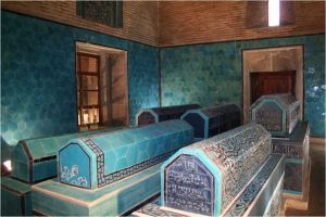
The tomb of Sheikh Sadreddin-i Konev

Sadreddin-i Konevî, one of the great mutasavvîs of Konya, died in 1210 (H. He was born in Malatya in 606. ...

devamını oku
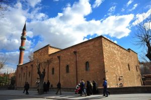
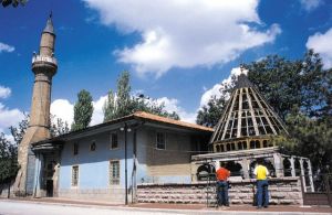
The Folding Mosque
The Folding Mosque

It's on Alaeddin Street. It was built after 1201 by Shemseddin Altunaba, expanded and renovated in 1332 by Somuncu Ebubekir. ...

devamını oku
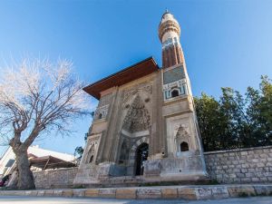
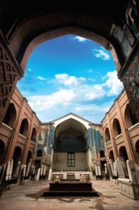
The Madrasah of the Scorpion

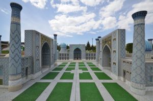
Sırçalı Madrassa is a 13th-century madrassa located in Konya. It's the madrassa of the century. It is a madrassa with ...

devamını oku
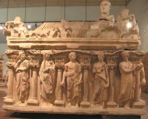
The Archaeological Museum of Konya

The Konya Archaeological Museum was founded in 1901 and moved twice before moving to its current location in 1962. ...

devamını oku
Sahib-i Ata Mosque and Cemetery

The architect of the abbey, built in 1277 by Sahib Atâ Fahreddin Ali, one of the viziers of the Anatolian ...

devamını oku
The Ethnographic Museum of Konya

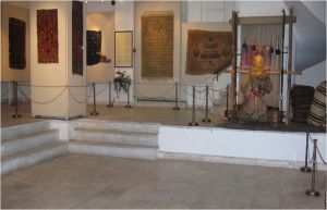
Initially built for educational purposes, the building was opened as the Museum of Ethnography in 1975.

devamını oku
The Mausoleum of the Firefighter

The tomb of Ateşbâz-ı Veli ⁇ nin is located within the boundaries of Meram district, southeast of Konya Education and ...

devamını oku
The vineyards of Konya Meram

Konya Meram Gardens stands out as one of the curious locations of Konya. It is an ideal option for those ...

devamını oku
The Tomb of Father Peacock

It's my grandfather's fault. We don't know where it is today. We estimate that this was at the dedication of ...

devamını oku
Owner of the Horse Foundation Museum

The architect of the abbey, built in 1277 by Sahib Atâ Fahreddin Ali, one of the viziers of the Anatolian ...

devamını oku
80 Binde Devr-i World Park is located in

Meram, which has the largest green area in Konya, is in a sense an open park and a place of ...

devamını oku
The Hamidi Park of the Black Lion

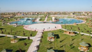
Karaaslan Hamidi Park, which has the distinction of being the largest park in Konya, covers a fairly large area and ...

devamını oku
Kilistra Ancient City

Kilistra Ancient City, Kilistra Ancient City is known as a settlement of Phrygian origin and became an important center during ...

devamını oku

Its altitude is 1016 m. It has an area of 1949 square kilometers. Meram district is located in the south and southwest of Konya. It is at the crossroads of five important roads: Ankara-Konya, Isparta-Konya, Antalya-Konya, Mersin-Konya and Adana-Konya. It is bordered to the north by Selçuklu, to the south by Çumra, Akören and Bozkır, to the west by Beyşehir and Seydişehir, and to the east by Karatay.

There is, of course, a parallel between the history of Konya, one of the meeting points of civilizations, and the history of Meram. The fact that Konya has been a center of settlement since ancient times and that the district of Meram is home to these settlements has led it to become a well-known and beloved place. The fact that an important place such as Çatalhöyük, which is considered to be one of the places where people came out of the cave and established the first settlement center and has a history of ten thousand years, is in Konya and the fact that the ancient city of Kilistra is located within the county boundaries also reveals the historical importance of Meram in general.

Meram, which has always had an exceptional place, has reached the present day under the identity of an Egyptian place, making a name for itself with its rare flower-like greenery that opens in the middle of the meadow, its gardens and its modern appearance.

The district, which has the honor of hosting many historical artifacts, also carries important artifacts from the ancient city of Kilistra into the future. In addition, a bridge over the Meram River built during the Seljuk period, the Hasbeyoğlu Mosque, the Hamam and Darülhuffaz, the Sheikh Sadreddin Konevi Mosque and Tomb, the Sırçalı Medrese, the Yplikçi Mosque, the Tavus Baba Tomb, the Ateşbaz Veli Tomb, the only tomb in the world made for a cook, the Girls' Rock, the Sahibi Ata Mosque and the Ash, the Archaeology Museum, the Ethnography Museum, the Sahib Ata Foundation Museum and the Atatürk House were the main places to visit.